

Kyoto’s Water Culture and the Hidden Reservoir That Sustained Its Legacy
Unveiling Kyoto’s Water Culture and Its Underground Lifeline

In this article, I will explore the water culture that has supported Kyoto for over 1,200 years, ever since the establishment of Heian-kyo in 794.
As I mentioned before, Kyoto, now one of the world’s leading tourist destinations, has a small, limited area known as “the true Kyoto.” Historically, however, this “the true Kyoto” was located slightly west of its current position, serving as the city’s main hub of development.
Yet, Kyoto’s history as a newly established city changed dramatically due to repeated natural disasters and epidemics. As a result, people abandoned their former residences and moved eastward, forming what we now recognize as modern Kyoto.
To comprehend this transformation, one must first understand the Kyoto Basin. Examining why people shifted from the western to the eastern part of the basin is crucial. Several factors contributed to this move, one of which is differences in geological conditions. This theory was first proposed by Harushige Kusumi, a professor at Kansai University’s Faculty of Environmental and Urban Engineering.
But why has Kyoto been able to develop and sustain so many traditional cultural practices for centuries? The key to understanding this lies in water.
From soba, wagashi (Japanese sweets), and matcha, to kimono dyeing, and even the aesthetics of Zen and wabi-sabi, water has played a foundational role in Kyoto’s cultural development.
To explore this further, one must look not at English maps but at Kyoto’s Japanese place names, which reveal fascinating insights.
Many place names in central Kyoto contain words related to water, such as:
Kawaramachi (河原町)
Shirakawa (白川)
Kawabata (川端)
Imadegawa (今出川)
Horikawa (堀川)
Oike (御池)
These names incorporate characters like 河, 川, 池—all related to water.
However, in modern Kyoto, these locations often no longer resemble their watery past. Visitors may struggle to see where these water sources once existed. The Kamo River in the east and the Katsura River near Arashiyama in the west remain, but they alone do not fully explain how Kyoto’s unique water culture developed.
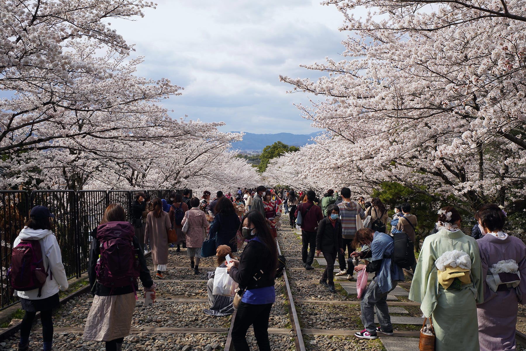
On the surface, Kyoto may not seem like a particularly water-rich city today. However, the Keage district near Nanzen-ji Temple, famous for its cherry blossoms, tells a different story. Even today, this area benefits from a canal bringing water from Lake Biwa, helping sustain Kyoto’s water culture.
Lake Biwa, Japan’s largest lake, spans approximately 60 km north to south and 20 km east to west, with a total water volume of 27.5 billion tons. To put this into perspective, the lake holds enough water to supply the 14.5 million people in the surrounding area for about 11 years.
Yet, Lake Biwa is not the most critical factor in Kyoto’s water culture. That distinction belongs to groundwater.
In reality, Kyoto’s history, spanning over 1,200 years, was sustained not by canals from Lake Biwa but by its abundant underground water reserves. When Heian-kyo was founded, large-scale canal construction was not feasible due to the imperial court’s financial constraints.
Despite these limitations, securing a stable water source was essential for the new capital’s survival. The aristocracy of the time learned from a particular source (to be discussed in another article) and discovered the vast underground water reserves beneath the Kyoto Basin.
In other words, Kyoto’s rise as a city was, in effect, made possible by groundwater. Without this underground water, Heian-kyo would not have endured, and Kyoto’s cultural evolution would have been impossible.
The Kyoto Basin, measuring 33 km from north to south and 12 km from east to west, contains a massive underground water system. Historical records indicate that southern Kyoto, near present-day Uji, was once home to a vast lake called Ogura-ike (巨椋池). The lake bed consisted of thick gravel layers extending 800 meters deep, proving that a large body of water once covered this region.
The primary locations where Kyoto’s groundwater resurfaces are at the confluence of three major rivers: the Katsura River, Uji River, and Kizu River. This area includes the site of Iwashimizu Hachimangu Shrine, which was once part of the Ogura-ike region.
Through extensive research, Professor Kusumi discovered that the Kyoto Basin holds an astonishing 21.1 billion tons of underground water—a volume comparable to Lake Biwa. He named this underground reservoir “Kyoto Water Basin (京都水盆)” and spent his career advocating for its conservation and sustainable use.
Why? Because he understood that the Kyoto Water Basin is the foundation of Kyoto’s cultural legacy.
Conversely, in today’s convenience-driven society, traditional wisdom about utilizing underground water is being lost, which inevitably leads to cultural decline.
Furthermore, it has been revealed that Kyoto’s distinctive climate—hot summers and cold winters—can also be attributed to the presence of the Kyoto Water Basin beneath the city.